Wednesday, 2 July 2014

Date ideas 2/7/2014 - Dead Sea

The Dead Sea is actually a very very salty lake (about 9 times saltier than the ocean). It has this high concentration of salts as the Dead Sea is a closed basin and termination point for a number of water sources. Over time these rivers have dissolved minerals and transported them to the Dead Sea. The water has evaporated, concentrating the minerals in the remaining sea water. (Interesting side note: the Dead Sea is located on the Dead Sea Transform, part of the Jordan Rift Valley). Many people visit the Dead Sea for it's supposedly healthful waters - I wonder if the water could be considered the opposite of Homeopathy?

Also, hills of halite (salt)!

Anyway, it looks beautiful and would be quite nice to visit if we could avoid the tourists.


Tuesday, 1 July 2014

Historic places I've been - Lake Purdiguluc, Colac, Victoria

Geophysics survey, Lake Purdigulac, 2009. -38.260268, 143.499328
Purdigulac is a nested maar complex of multipe vents and some scoria cones. It lies south of the Red Rocks complex and right in the middle of the Eastern Volcanics. It was a pain to survey as the lake occasionally fills with water and the concentration of salts creates meter deep cracks in the sediments at the bottom of the craters during dry times. Flicity (volcanologist), Tegan (volcanolo-physicist) and I (geo-physicist) quite enjoyed our time exploring this volcano.


 An image of the Red Rocks complex taken nabbed from the AltonaBeauty blog. Purdigulac is part of the Red Rocks Complex which contains at least 9 craters and a number of scoria cones. Work by Teagan Blakie and Flicity Piganis has identified that Purdigulac is one of the most complex craters in this complex with at least 9 eruptive points and shallow diatreme structures with multiple coalescing vents.

Wednesday, 18 June 2014

Date ideas 18/6/2014 - Sudbury Igneous Complex

46.673363, -81.025603
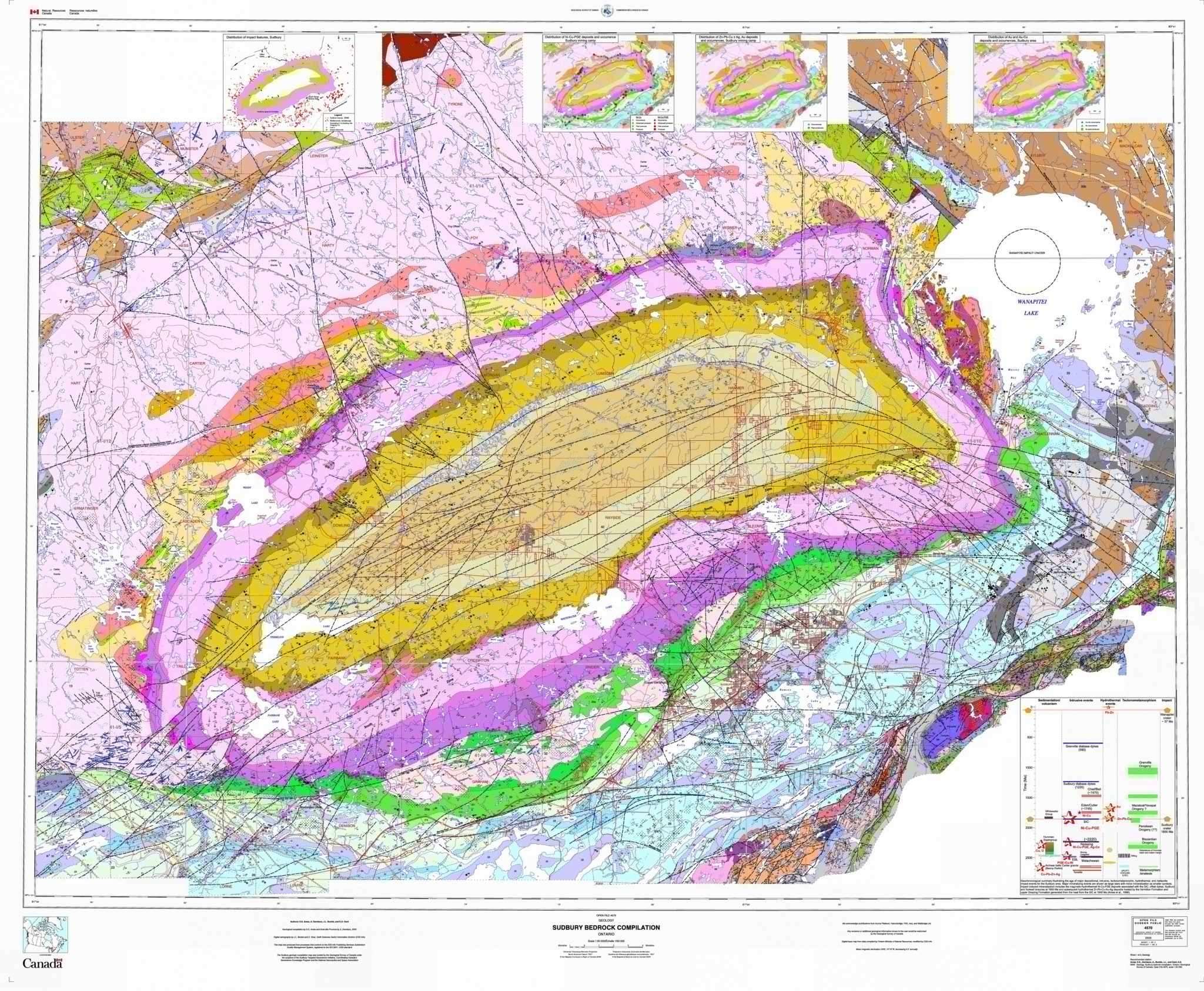
I've been marking honours exercises recently and as a result I've developed a temporary interest in the Sudbury Igneous complex. This mineralised region is the result of a meteorite impact. The impact shattered the country rock and the super high temperatures melted the sulphides. These then settled around the breccia creating banded massive sulphides. It's much more complex than that, but I haven't examined this case study all that deeply. I'd like to fix that though... this would make a lovely couple of weeks camping trip. I wonder if we could finagle a mine visit or three.

Fall back breccia - Black Onaping Formation with pink granitic clasts. Image hosted by Mindat.com (which is awesome, you should visit it!)


A well studied area due to to mineralisation - every one likes a geological map. Image hosted by the University of Western Ontario

Sunday, 15 June 2014

Field trips - Billa Kalina in the Womera Protected Area

 Sunset in the South Australian desert during winter - cold but beautiful.

 
The Woomera Prohibited Area! 

I have recently completed a short field trip to the Womera Prohibited Area. This zone covers an area greater than England in the South Australia arid area. Still occasionally used for jet / missile (and things) testing, much paperwork is required to gain access. The company I currently work for has a couple of tenements in this area so my boss decided we should go up there and oggle the rocks. Given this area is in the Gawler Craton there weren't many rocks to look at, but we made the most of the ones we could find.


 A normal fault in some Bulldog Shale. The resistant layers are reinforced by gypsum and have been displaced by approximately 15 meters.


There were three of those pod like structures separating two different mudstones / weathered shales.  Below the main outcrop, slightly sandy and more resistant layers can be seen (near write-in-the-rain fieldbook)

In some sections of the pod, cross beds can be seen.

The edges of the pods show the bedding of the mudstone wrapping seamlessly around them. This + xbeds suggests to me that these are paleo-channels. The Bulldog shale is thought to have formed in shallow marine conditions during oceanic transgression.

Not on our patch, but we visited some Adelaidian sediments anyway. This hills were mostly composed of quartzites and conglomerates. Note the 6m high sand dunes in the middle distance and the lack of topography so typical of this area.

 Getting around is SO much easier when you have a Gator.

Wednesday, 11 June 2014

Date idea 11/6/2014 - Alpine nappe folds

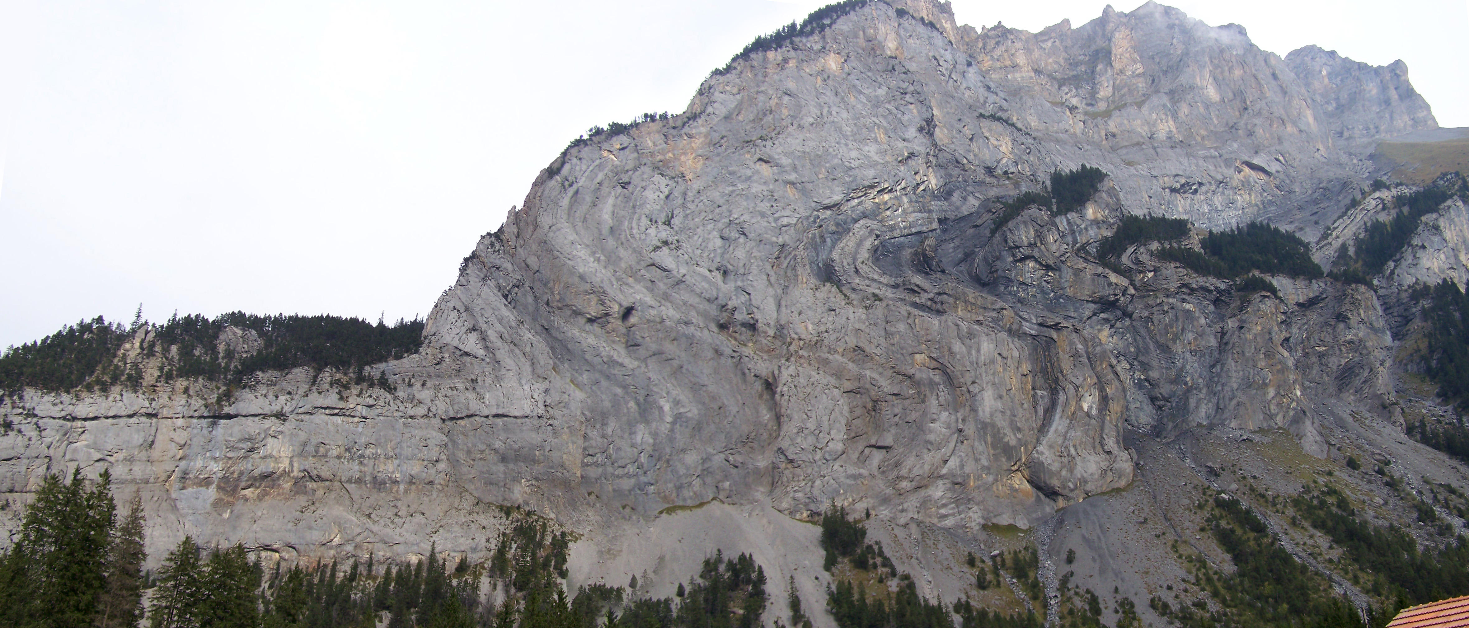
Being a geologist with a decideily structural bent, I like folds and figuring out the deformation history of the rocks. So apart from the great hiking this site would provide, I'd also love to get up close and personal with the nappes.

This image was nabbed from Wikimedia. It was uploaded by Woudloper with the following caption: "Detachment folding in Lower Jurassic limestone layers of the Doldenhorn nappe, Gasteretal, Switzerland. Location is at the Waldhus, looking north. Scale of the outcrop is about 1 km from left (west) to right (east). Mountain ridge is from Jegertosse (2154 m, left) to the Innerer Fisistock (2787 m)"

For more great nappe images go here and here

Wednesday, 4 June 2014

Date Ideas 4/6/14 - Anti-Atlas Mountains, Morocco

Not that we need a reason to visit Morocco, but I am rather partial to folds and fold interference patterns such as those seen in the Anti-Atlas Mountains in Morocco.

29 27 26.62N, 08 38 40.69W Kindly provided as a desktop mapping project by these guys.