Showing posts with label Date. Show all posts

Saturday, 1 August 2015

On a date with a geologist - Date 4, part 1.

Wall made of local stone at The Cloisters. 

Date four was amazing! We traveled to various locations in Eastern America and saw a lot of rocks. We spent a day checking out The Cloisters, a museum dedicated to Medieval art in New York to satisfy my other interests. The museum overlooks the Hudson River and is composed of three reconstructed cloisters acquired from various areas in Europe as well as a great many artifacts and artworks from the 12th - 15th century. The buildings are based in a beautiful park land and feature both imported and local stone. One of the beautiful rocks used for the carpark walls is a local garnet schist. It has undergone significant metamorphism and shows bands of garnets as well as aluminosilicates.
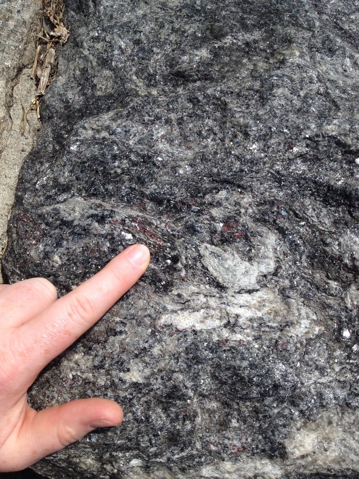
Garnet in the schists

We did take a moment or two to head out onto a balcony and take some happy snaps of the river, the bridge we crossed onto the island over and of course, each other. Out here we discovered some interesting things.

The river.

Part of The Coisters are clad in micro-granite blocks. I do not know if they are local but given the presence of the schist, it stands to reason there was once a local subduction zone so there should be some local granites forming. Some of these micro-granite blocks feature lovely aplites dykes as pictured below. Aplite is a fine grained intrustive rock composed of quartz and feldspare (thus the pink colour). It is often produced as the final spurt of melt which fills in / takes advantage of small cracks in the rapidly cooling batholith.

Aplite dyke in a micro-granite blocks.

The balcony has also been crafted of local stone and displays a rather lovely meta-psammo-pelite aka gneiss. Below is a photograph of a rather lovely specimen showing dark and light banding.


Sunday, 1 June 2014

Historic places I've been - Mt Tamborine, Queensland

Mount Tamborine is the remnants of the edge of a shield volcano. In 2012 I found this more resistant bit, or possible dyke on the side of the road and had to stop and pose with it. I know nothing of the local geology except Brisbane area is one giant volcano (possibly hotspot related) and as a result they appear to have ignimbrite as their paving stone of choice (Melbourne uses Basalt - what does your city use?). It's on the side of a road around -27.909855, 153.181835.


Further down the road at Ceder Creek Falls, -27.894321, 153.185086. It's hard to take a selfie AND capture what looks like a contact between lava flow and ignimbrite (on the right)

Large clast in the ignimbrite with bracelet for scale - no compass, no geopick, no handlense and no scale bar, what sort of holidaying geologist am I?


Late stage faulting with quartz/calcite? infill - where's your hardness kit when you need it?

And finally what we came here for - Ceder Creek Falls looking down at the main pond. This is the best shot - I got everything else came out blurred. I suspect this'd be a lovely place to swim in summer.

Saturday, 10 May 2014

On a date with a geologist - 12 Apostles, March 5th&6th

In March we took a trip down the coast to admire the 12 Apostles (Port Campbell Limestone). It was a lovely two days away traveling down the great ocean road, showing Tyr a little piece of Australia. Eventually we ended up at the 12 Apostles right around sunset. Not the best time for taking photos but grand nonetheless. (also, quite windy)
Obligatory photo - me in front of the 12 apostles, notice the downed stack on the bottom left? It fell in 2012. Erosion of the limestone happens at about 2cm every year but some stacks are weaker than others.

The top of the limestone cliff the visitor platform rests on, can you see the fault?

Tyr introduces the eastern stacks. I adore exploring with this man!

One of the stacks from the beach the next day. I believe the slightly more weathered band (greyish) is a marl.

Om nom nom... when one can, one should taste the rocks. (I find it amusing that the stack is in slightly more focus than the delicious man.)

Or if you don't eat it, climb on it - because climbing up the rubble from an unstable cliff seems like a good idea at the time! The layer just above my head is that marl again. These boulders are huge!


Saturday, 1 March 2014

On a first date with a geologist


Hello and welcome to our first date!

Some people like to tour breweries, others prefer to hunt down hole-in-the-wall eateries. Me? I like to look at rocks. This blog is dedicated to exploring relationship while admiring the scenery. I'm sure, in between poorly focused pictures of my rockpick, you'll learn plenty about my travels and the geology I encounter as I go. So without further ado I present, our first date:

Organ Pipes National Park (-37.667475, 144.766318) was the first National Park established due to geological formations in Victoria. The land used to be a sheep farm and has been since been rehabilitated. n other words, the local volunteers have gotten rid of all the weeds, encourage the wildlife and, most irritatingly, grown plants to cover up the outcrops. The park features a number of walks but four main geological attractions, three of which are available to the general public. The first, the organ pipes, are naturally occurring columnar basalt structures that look like, you guessed it, organ pipes. These form when the basaltic flows fill up a depression. The lava then cools from the top down, contracting as it goes. This creates vertical cracks which split into almost 120 degree angles (triple junction anyone?). Weathering and slight decompression create horizontal fractures resulting in columns that appear to be stacks of edam. Flows cool at different rates and in different directions creating a range of column stacks. Such structures should always be appreciated with an appropriate bottle of wine.


The second outcrop on the menu is the Rosette Rock - a radial igneous formation. Formed from the same process as the Organ Pipes, the radial nature of this formation suggest it was either a slowly cooling lava tube or the lobe of a flow. Either way, decidedly beautiful.

The third remarkable geological feature of this national park is one most people can't find, don't care about and actually shouldn't climb the hill to look at. We, being geologist, simply had to oggle this rare occurance.


The basal contact of the basalt flow over the Silurian mudstone. The mudstone has metamorphosed into hornfels (white). As you can see from the scale, this process produces very little hornfels. The straight / clean contact between the two rocks confirms that the mudstone had been lithofied prior to the lava flow. This outcrop is exciting because when mapping in Victoria, it's so rare to actually SEE the contact.


I highly recommend picking up a nice picnic and setting out to see this National Park. We had lunch on the tessellated pavement with a babbling brook at our feet. The company was delightful, the rocks impressive and the weather was great (for Melbourne anyway).